Experts: Warmer Waters Might Ignite Hurricane Idalia’s Intensity
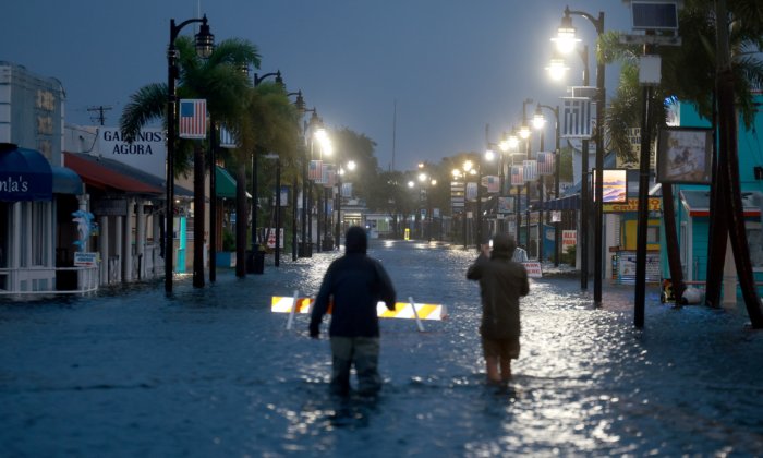
Hurricane Idalia, which made landfall along Florida’s Big Bend region on Aug. 30, could top records in its intensification rate, hurricane experts have warned.
Hurricane Idalia, which made landfall along Florida’s Big Bend region on Aug. 30, could top records in its intensification rate, hurricane experts have warned.
The hurricane eventually touched down as a Category 3 storm near Keaton Beach, along the Apalachee Bay, at around 7:45 a.m. ET, after experts had warned overnight it could intensify into an “extremely dangerous” Category 4 storm.
Related Stories


Hurricanes, which are not an uncommon occurrence in Florida, typically form over warm ocean waters; building up energy as they suck up hot air from those waters while forming an area of low pressure underneath.
Hurricane Professor Kerry Emanuel, who teaches at the Massachusetts Institute of Technology (MIT), said that Idalia “stands a chance of setting a record for intensification rate because it’s over water that’s so warm.”
“Right now I’m pretty sure Idalia is rapidly intensifying,” Mr. Emanuel said.
At the time Emanuel said that, Idalia was clocking 80 mph winds. A couple hours later it was up to 90 mph, and by 10 p.m. Idalia was a Category 2 hurricane with 110 mph winds, having gained 40 mph in wind speed in 21 hours.
‘Rocket Fuel for the Storm’
Colorado State
Source link