Powerful ‘coast-to-coast storm’ forecasted to impact US following snowy weekend | US News
More than a foot of snow has fallen in parts of the northeastern US – and the worst is yet to come as forecasters warn a major “coast-to-coast” storm is imminent.
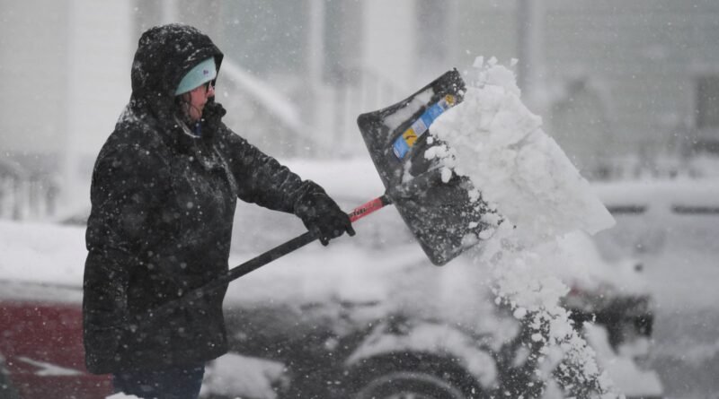
Areas of Maine and Massachusetts were inundated at the weekend, with images showing people shovelling around their properties and snow ploughs clearing icy highways.
Hundreds of flights at Boston’s Logan Airport were cancelled or delayed, according to flight tracking sites, but the city itself and the coast had much less snow than inland.
UK weather latest: Snow hits as South East in for ‘biggest shock’ from cold
Vermont saw accumulations of six to 12 inches (15 to 30 cm), while there was freezing rain around the central Appalachian mountains.
A foot of snow was also reported in parts of Monroe County, Pennsylvania, and 11 inches (27 cm) in New Jersey’s Sussex County.
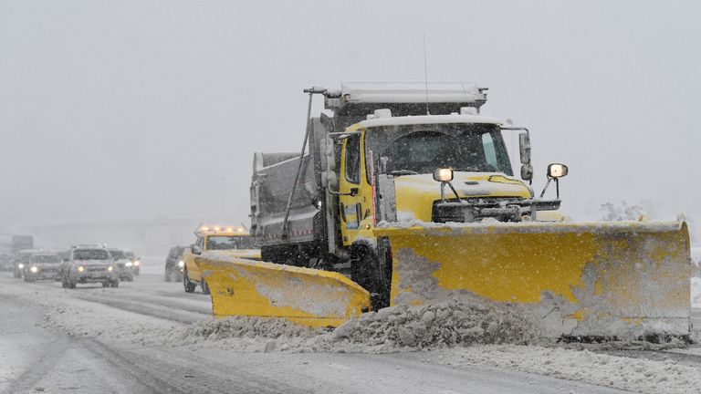
A snow plough clears the road along the Massachusetts Turnpike
Grafton, Massachusetts
New York City escaped with rain but surrounding counties had notched up double-digit totals by Sunday morning.
The western US was also affected, with a winter storm over the Sierra Nevada mountains cutting power to tens of thousands in Reno.
Police were also forced to close a section of Interstate 80 due to multiple accidents and cars skidding off the road.
Much of America is now on alert after the National Weather Service said “significant winter storms” would affect the country this week.

The New England Patriots v New York Jets was played in very tricky conditions
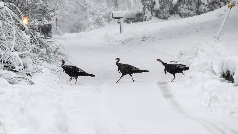
Turkeys headed out for a walk in Worcester, Massachusetts. Pic: AP
An “extremely dangerous” and “ferocious” blizzard with whiteout conditions and 70mph gusts is forecast for northeast New Mexico, eastern Colorado, the Oklahoma and Texas Panhandles, western Kansas and southwest Nebraska.
“Travel will become extremely dangerous to impossible,” the NWS warned.
It said “bursts of heavy snow” could deposit up to two inches of snow per hour could in the Plains and Midwest, making for treacherous driving conditions.
The warning is in force from 8-11 January, and it’s not just snow that could cause serious problems.
The forecaster said powerful winds are likely to cause “widespread coastal flooding” on the Gulf Coast and eastern US from Monday until Tuesday.
Severe thunderstorms – capable of whipping up tornadoes – could also hit the central Gulf coast and southeast Texas late Monday into Tuesday – before spreading into parts of Alabama and Florida.
“Very strong and damaging winds as well as a few tornadoes will be the main threats,” said the NWS.
Several feet of heavy snow is also forecast in the Pacific Northwest on Monday and Tuesday as back-to-back storms plough through the Cascades region.
This storm system is “forecast to dig across the Western US through Thursday and reach the Plains late in the week”, the NWS added.