China Grapples With Extreme Weather as El Nino Approaches
China has been grappling with floods and a heatwave in recent months, with certain regions facing record-high heat and heavy downpours as the El Nino weather conditions approach.
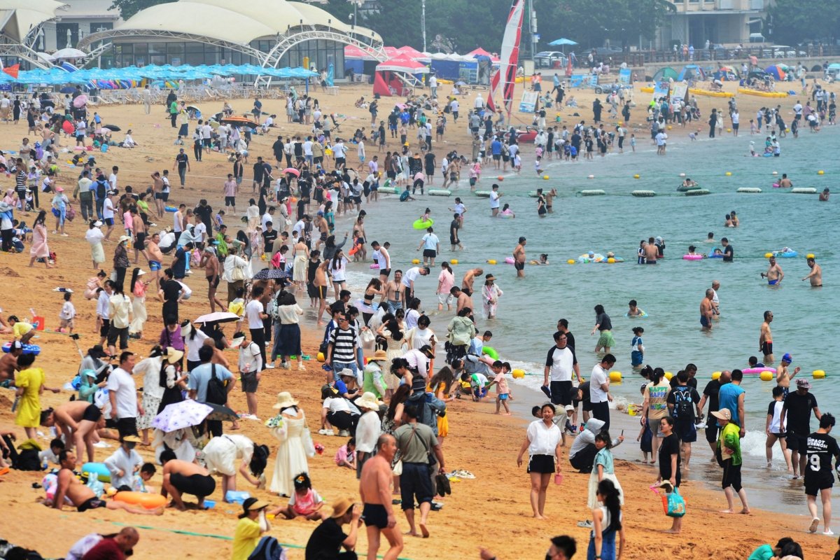
The state-run Global Times reported Sunday that a total of 185 red alerts for hot weather were issued on June 23 across the country, including in the capital city of Beijing, Tianjin, Shandong, and Hebei.
A red alert is the highest level in China’s four-tier warning system, which signifies the temperature could exceed 40 degrees Celsius (104 degrees Fahrenheit) within 24 hours.
On June 23, Beijing baked in temperatures as high as 40.3 Celsius, after sizzling at 41.1 Celsius the day before.
The heatwaves, the second round in about 10 days, were caused by warm air masses associated with high pressure ridges in the atmosphere. The effect was amplified by thin cloud cover and long daylight hours around the summer solstice, according to Chinese meteorologists.
The heatwaves also prompted authorities to step up efforts to safeguard crops and ensure the safety of tourists. Outdoor work was also halted during the hottest part of the day.
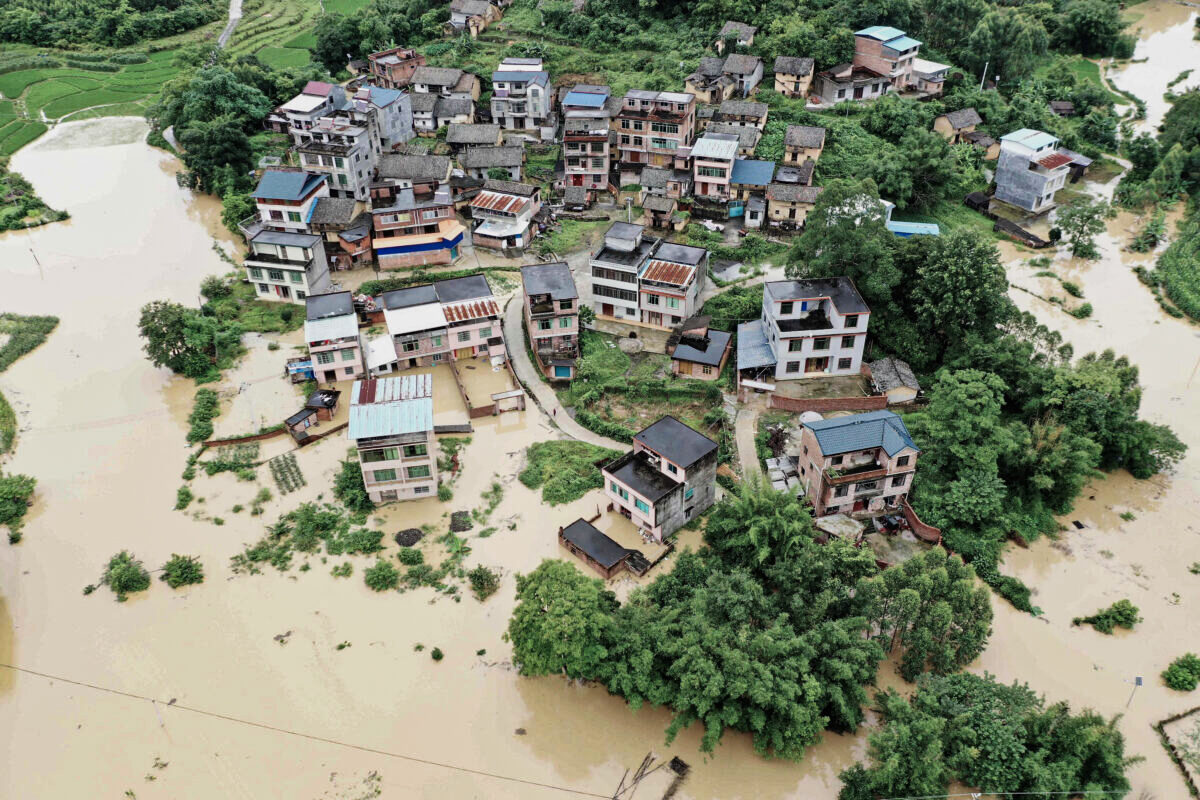
Meanwhile, heavy rainfall was reported in southern regions of China, including Hunan, Guangdong, and Zhejiang. The China Meteorological Administration warned that Anhui and Sichuan could be at risk of floods.
El Nino Weather Conditions
Ma Jun, director of the Beijing-based Institute of Public and Environmental Affairs, told Global Times that the weather patterns in China were aligned with the El Nino change of climate.
“The persistent occurrence of extreme heat can further contribute to the development of compound meteorological disasters, affecting local agricultural and industrial production, water resources, ecological environment, energy supply as well as people’s daily life,” Ma said.
The U.S. National Oceanic and Atmospheric Administration (NOAA) declared on June 8 the arrival of El Nino, a natural climate phenomenon marked by warmer-than-average sea surface temperatures in the central and eastern Pacific Ocean near the equator.
The agency noted that El Nino occurs every two to seven years on average, and it can bring heavier rain to some parts of the world or drought in others. On its website, NOAA said that the weather phenomenon was expected to come, saying that it will be “moderate-to-strong” by the fall and winter months.
“El Nino’s influence on the U.S. is weak during the summer and more pronounced starting in the late fall through spring,” said NOAA.
By the winter, there is a forecast an 84 percent chance of “greater than a moderate strength El Nino” and a 56 percent chance of a “strong” El Nino, it said.
El Nino, which means “Little Boy” in Spanish, is the warm phase of the El Nino–Southern Oscillation. The opposite, La Nina, means “Little Girl,” and it means that surface temperatures in the eastern and central Pacific Ocean near the equator are lower than the average.
According to NOAA’s website, an El Nino event generally lasts between 9 and 12 months. La Nina events, in contrast, can last for years at a time.
“During El Nino, unusually warm sea surface temperatures in the central/eastern tropical Pacific lead to increased evaporation and cooling of the ocean. At the same time, the increased cloudiness blocks more sunlight from entering the ocean. When water vapor condenses and forms clouds, heat is released into the atmosphere,” NOAA wrote in a 2022 blog post.
Jack Phillips and Reuters contributed to this report.