Tropical Storm Warnings Extended to Cover More of Florida’s Gulf Coast
Florida’s Governor Ron DeSantis provided updates on preparations from various government entities ranging from the Florida National Guard to the Department of Health.
Almost all of Florida’s west coast is currently under either a Tropical storm watch or warning according to the National Hurricane Center (NHC) in its 5 p.m. EDT advisory. A storm surge watch has also been issued for most of that area.
Tropical storm warnings—including expected tropical storm conditions within 36 hours—are currently in effect for a segment of southwest Florida from East Cape Sable to Boca Grande, covering areas like Port Charlotte and Fort Myers.
A tropical storm watch, indicating potential tropical storm conditions within 48 hours, is in place for the lower Florida Keys south of the Card Sound Bridge, Dry Tortugas National Park, and the Florida coast north of Boca Grande to the mouth of the Suwannee River.
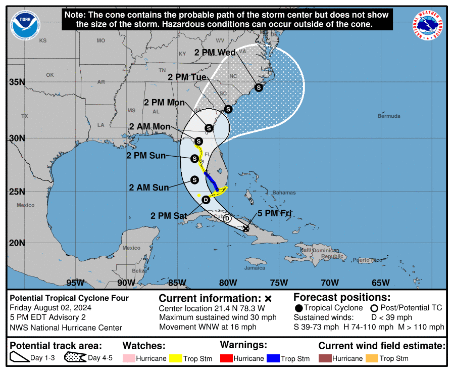
The National Weather Service defines a tropical storm as featuring winds between 39 and 73 mph. The “Potential Tropical Cyclone Four” recorded sustained winds of 30 mph as of 5 p.m., with the advisory projecting it to evolve into “Tropical Storm Debby” by Aug. 4.
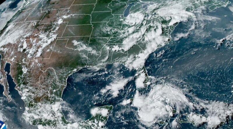
The storm is on its way to the Gulf of Mexico through Cuba and seems to have decelerated during the day.
Related Stories


The likelihood of tropical cyclone formation in the next 48 hours has now reached 80 percent.
A storm surge watch has been put in place for the strip of Florida’s west coast stretching from Bonita Beach to the Suwannee River, encompassing areas like Tampa Bay and Charlotte Harbor.
Storm surge predictions indicate two to four feet of surge in those regions.
An expected storm surge of one to three feet is in store for the area from Card Sound Bridge to Bonita Beach.
The NHC still anticipates the storm to bring four to eight inches of rainfall over parts of Florida and the southeastern United States, commencing this weekend and lasting until the morning of Aug. 7, with some areas potentially experiencing up to 12 inches of rainfall. Flash and urban flooding, as well as river flooding, are potential consequences according to the NHC.
The storm’s projected path has slightly shifted westward, with the cone of uncertainty now centered slightly further north along the natural coast.
Maximum sustained winds are now expected to surpass 50 mph by around 2 p.m. on Aug. 4, when the storm is projected to be near Tampa Bay.
The NHC foresees the storm reaching its peak strength with sustained winds of 63 mph on Aug. 5, potentially making landfall in the nature coast and big bend area. Following North Florida, it is expected to trek northeast, traversing the coastal regions of Georgia and the Carolinas.
On Aug. 1, Florida Governor Ron DeSantis announced a state of emergency for over 50 counties. This declaration includes all counties along the Gulf Coast and the Panhandle.
The governor’s office provided several updates on storm preparations on Aug. 2.
The Florida Division of Emergency Management activated the State Emergency Operation Center to level one and is spearheading coordination efforts.
Around 3,000 Florida National Guard Members are preparing for response actions, and the Florida State Guard has mobilized 70 members for response and recovery assistance, along with nine shallow water vessels, 10 UTVs, two amphibious rescue vehicles, and seven search-and-rescue teams.
The Florida Fish and Wildlife Conservation Commission (FWC) and the Florida Department of Law Enforcement are gearing up for prompt response operations. The FWC has also issued advisories to boat owners to secure their watercraft in anticipation of severe weather conditions.
The Florida Department of Transportation is collaborating with the Emergency Operations Center to make necessary arrangements, including assessing flood vulnerabilities, securing construction sites, and replenishing fuel supplies.
Various other departments and officials have commenced storm preparations, from Attorney General Ashley Moody’s office activating the Florida price gouging hotline to the Florida Department of Health deploying 90 ambulances to facilitate emergency evacuations across the state.