NSW Braces for Flooding as Dam Levels Rise
Prepare for another wet and stormy weekend in New South Wales (NSW) as widespread rain and thunderstorms are expected to hit much of the state.
The South Coast and Illawarra regions are bracing for the heaviest downpours of up to 200 millimetres, leading to flash flood warnings.
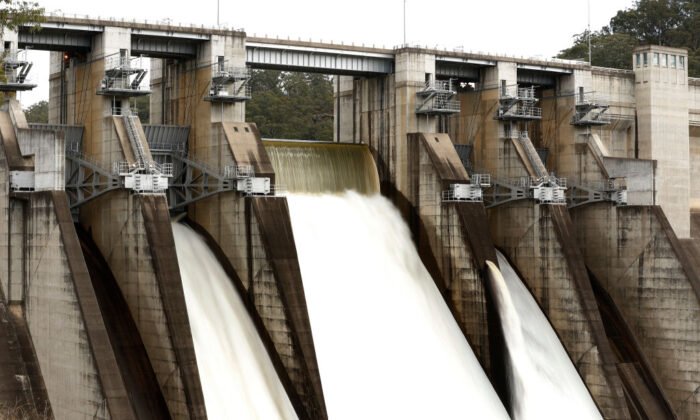
Sydney’s Warragamba dam, already at 99 percent capacity, is predicted to spill over, posing a flood risk to areas downstream.
Meteorologist Sarah Scully from the Bureau of Meteorology forecasts coastal areas to receive between 50 and 100 millimetres of rain on the night of May 10.
Inland areas could see isolated total rainfall between 50 and 70 millimetres, with thunderstorms likely to increase the rate of rainfall and the potential for road closures.
Related Stories


Expect the heaviest rainfall to start on May 11 as the rainband moves towards southeast NSW.
Severe thunderstorms in the Sydney Metropolitan area and Illawarra region will heighten the risk of flash floods.
Southern areas may experience rainfall totals between 70 and 100 millimetres, with a potential for up to 200 millimetres in a 24-hour period.
The NSW State Emergency Service warns of possible Hawkesbury River flooding and isolated minor flooding in the Hawkesbury Nepean Valley.
Keep an eye out for severe weather warnings for heavy rainfall affecting northern South Coast, southern Illawarra, and eastern Southern Tablelands from May 11 into May 12.
Neighbouring regions in Queensland and Victoria are also expected to experience wet weather conditions.