Ontarians Urged to Make Emergency Preparations Ahead of Severe Winter Storm
Ontario’s weather agency is urging residents to have emergency kits prepared ahead of a severe storm that is hitting most of the country with blizzards and extreme cold.
Environment and Climate Change Canada (ECCC) released the warning on its social media account for Ontario, saying at around 6:25 p.m. on Dec. 22 that the agency has upgraded winter storm watches to “winter storm alert” or “blizzard alerts” for most parts of northern Ontario.
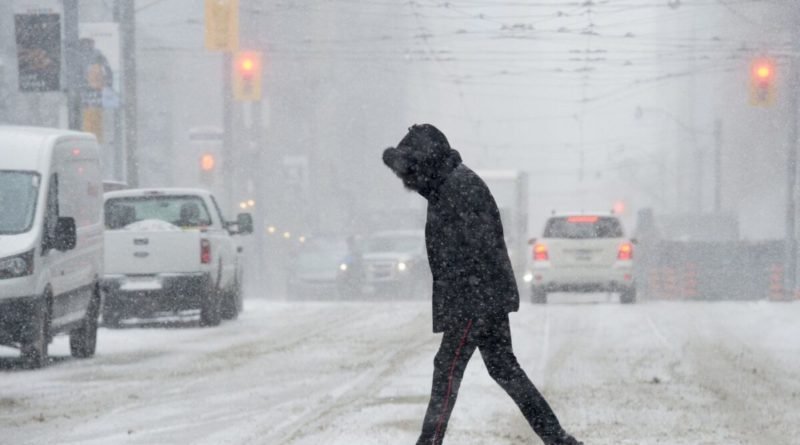
ECCC has issued winter storm or blizzard alerts for all of southern Ontario, where major storms with winds gusting up to 90 km/hr will strike areas including Toronto, Hamilton, London, and the Peel region on Dec. 23 and Dec. 24. The strong winds will create “widespread blowing snow,” which will reduce visibility to near zero at times, the agency warned.
Wind chill in southern Ontario is expected to drop to minus 20 degrees, while some northern regions of the province will see minus 40-degree wind chill as early as Thursday night.
ECCC Weather Ontario has urged residents to prepare emergency kits, which should contain water, canned food, and battery-powered flashlights.
“Don’t wait for the storm to get your emergency kit ready!” the agency said on social media. “You must be self-sufficient for at least 72 hours.”
The storm is expected to affect 20 million Canadians over the Christmas holiday, Environment Canada said.
⚠️⚠️Alert Update⚠️⚠️
All winter storm watches in nrn ON have been UPGRADED to winter storm WARNINGS OR blizzard WARNINGS due to
snow ❄️ + blowing snow 🌬️ = Near ZERO visibilities
Blowing snow advisories have also been issued.
➡️ https://t.co/YUzlgp9F6A#ONStorm #ONWx pic.twitter.com/h1aux0metW— ECCC Weather Ontario (@ECCCWeatherON) December 22, 2022
Environment Canada has also issued extreme cold warnings for all regions across the Prairies.
Warnings of extremely cold wind chill that values between minus 40 to minus 55 degrees are in effect for Alberta, where the temperature will turn milder later this weekend, the agency said. Warnings of extreme cold of at least minus 40 degrees are also expected for regions across Manitoba and Saskatchewan.
A mixture of extreme cold and winter storm warnings and special weather alerts have been issued for British Columbia, where the temperature values are at minus 35 overall, and could drop to nearly or below minus 40 in some regions.
Residents in Quebec and Atlantic Canada should brace for freezing rainfall, heavy snowfall, and strong winds gusting over 100 km/hr in many areas. Heavy snowfall of between 30 centimetres to 50 centimetres is reported for some parts of southern Quebec, and may even reach up to 80 centimetres in some cases.
A “Wreckhouse wind warning” has been issued for Channel-Port aux Basques and its vicinity in Newfoundland and Labrador, as wind with a maximum gust of 150 km/hr will be blasting from the evening of Dec. 23 to the afternoon of Dec. 24. Wreckhouse wind warnings are issued when there is a significant risk of damaging winds.
“Strong southeasterly winds will rapidly increase Friday night with gusts reaching 150 km/h overnight into Saturday. Winds will ease upon shifting to southwesterly Saturday afternoon,” Environment Canada said.
“Be prepared to adjust your driving with changing road conditions due to high winds. Very strong wind gusts can damage buildings, down trees and blow large vehicles off the road.”

Andrew Chen is an Epoch Times reporter based in Toronto.